USA: Corps Proposes Dredging of Portsmouth Harbor and Piscataqua River FNP
The U.S. Army Corps of Engineers, New England District is proposing periodic maintenance dredging and advanced maintenance dredging of a portion of the Portsmouth Harbor and Piscataqua River Federal Navigation Project (FNP) in New Hampshire and Maine.
The authorized FNP in Portsmouth Harbor and the Piscataqua River consists of a main ship channel, 35 feet deep and 400 feet wide extending from naturally deep water in Portsmouth Harbor to a point about 1,700 feet upstream from the Atlantic Terminal Sales Dock in Newington; a 950-foot-wide turning basin above Boiling Rock and an 850-foot-wide turning basin at the upstream limit of the project; a channel, 6 feet deep and 100 feet wide from Little Harbor through the Rye-New Castle drawbridge northerly between the mainland and Leach’s Island to deep water near Shapleigh Island; and a channel, 6 feet deep and 75 feet wide up the Sagamore Creek with an anchorage 6 feet deep and 3 acres in area, in Sagamore Creek.
The work site is a segment of the authorized 35-foot-deep main ship channel in the Piscataqua River portion of the FNP, referred to as the “Simplex Reach.” The Simplex Reach is located above the I-95 highway bridge and extends from just south of the Tyco Integrated Cable Systems Wharf in Newington, NH, to just below the 35-foot-deep turning basin at the head of navigation.
“The proposed work consists of periodic maintenance dredging and advanced maintenance dredging of up to 50,000 cubic yards of clean sand and gravel to remove hazardous shoaling from the channel in the Simplex Reach,” said Project Manager Bill Kavanaugh, of the Corps’ New England District, Programs/Project Management Division.
The Piscataqua River is known for strong tidal currents that make navigating the river difficult. The facilities at the head of navigation receive more than 43 percent of the cargo being shipped to Portsmouth Harbor. The vessels serving these facilities consist primarily of deep draft vessels including petroleum tankers with drafts of 30-36 feet. “Shoaling causes tidal delays for these vessels and increases the chances of ships grounding,” Kavanaugh said. “Maintenance dredging is required about every 6-10 years to remove shoals that hinder navigation for deep-draft vessels and to return the project to its authorized dimensions.”
The last maintenance dredging and advanced maintenance dredging was performed in 2000 when 7,900 cubic yards of material were removed from the Simplex Reach area of the FNP and placed at an in-river disposal area located about 3,000 feet seaward of the dredging area.
As part of this proposal, advanced maintenance dredging to -42 feet deep in the authorized 35-foot-deep channel is being considered. Advanced maintenance dredging has been performed several times previously in the Simplex Reach and has extended the time interval between maintenance dredging events thereby decreasing the potential environmental impacts to the area and reducing the overall cost of maintaining the project. Advanced maintenance dredging is not being proposed over the entire reach, but only in those areas within the authorized channel that have shoaled above –35 feet deep.
Dredged material will be placed in a previously used, in-river disposal area located about 3,000 feet seaward of the dredging area in a section of the river where depths exceed 50 feet. The material to be dredged has undergone physical analysis and it is the Corps’ preliminary determination that the material is acceptable for disposal at the previously-used, in-river disposal site
Alternate disposal areas and methods have been considered as part of this proposal. Alternative disposal options considered included open-ocean disposal, beach disposal, and upland disposal. The Corps favors the previously used, in-river disposal area option because it is environmentally-sound, cost-effective and it keeps the clean sediments in the river’s sand budget.
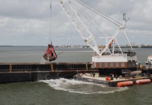
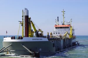
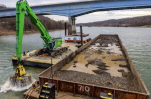
The proposed work will be performed with either a hopper or mechanical dredge during a 3-5 week period between Dec. 1 and March 15 in the year(s) when necessary and when funds become available. Pease Development Authority, Division of Ports and Harbors, is the local sponsor for this proposed project.
The Corps has assessed the effects the dredging is likely to have and has made a preliminary determination that there will be no significant impacts on resources or the environment. An Environmental Assessment for this work is being prepared and will be available for review.
The proposed work is being coordinated with the following Federal, state and local agencies: U.S. Fish and Wildlife Service; U.S. Environmental Protection Agency; National Marine Fisheries Service; Maine Department of Environmental Protection, Bureau of Land and Water Quality; Maine State Planning Office; Maine State Historic Preservation Commission; New Hampshire Department of Environmental Services, Coastal Program; New Hampshire Department of Environmental Services, Watershed Management Bureau; New Hampshire State Historic Preservation Office; and the Pease Development Authority, Division of Ports and Harbors.
[mappress]
Dredging Today Staff, February 20, 2012


